Aether
Koverse edge system · Lead designer · SAIC, 2021–2025
Aether is the edge system of SAIC’s Koverse Data Platform: sites around the world publishing streams of sensitive data, with every record locked to the people cleared to see it. The engineering worked. Adoption didn’t. I was brought in early in my career, often the least technical person in a room of PhDs and data scientists, and my job turned out to be asking the questions everyone assumed were already answered.
The original is classified, so everything below is a working rebuild.
Two jobs
The site. An edge site publishes its streams and decides, down to a single field, who can read them. Access runs on attributes, so the screen shows what each choice will release before it happens.
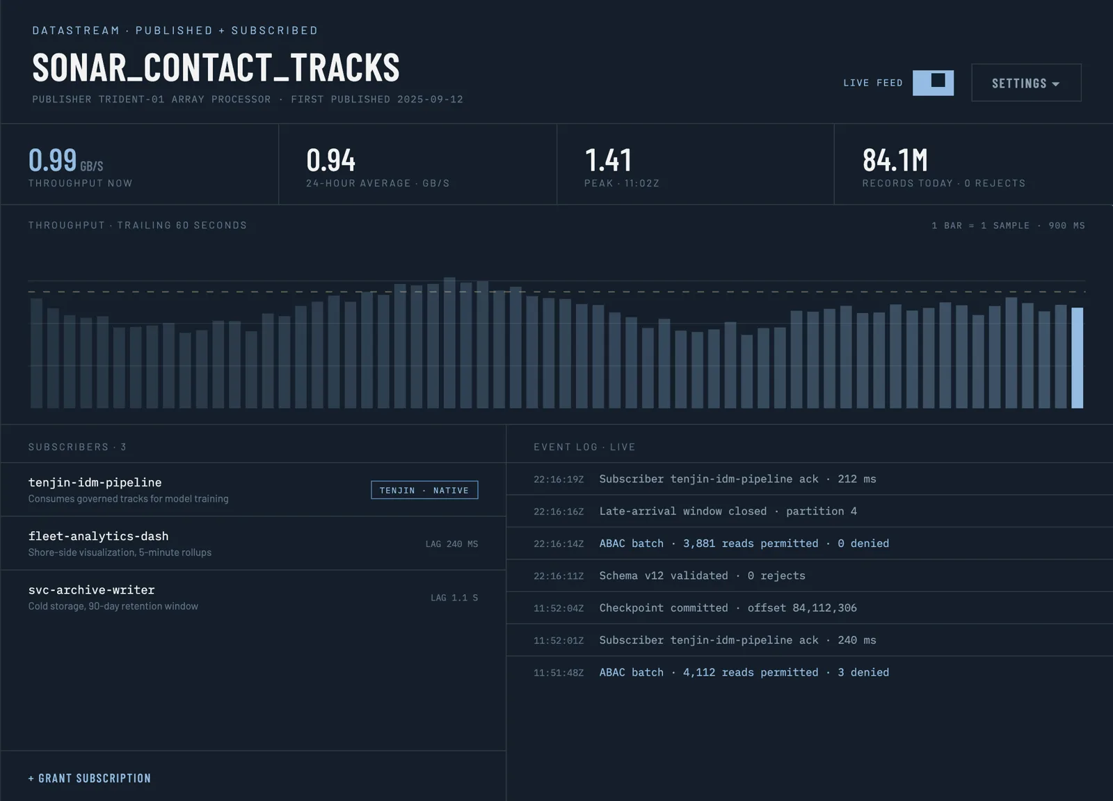
Datastream
A site’s published stream, who subscribes to it, and every read decision as it lands.

Import confirmation
Shows exactly what the import will release before you click, because once a record has been read, it can't be pulled back.
The admin. One dashboard to see every site and stream, route data, and manage who subscribes to what, including sites that can never be shown on a map.
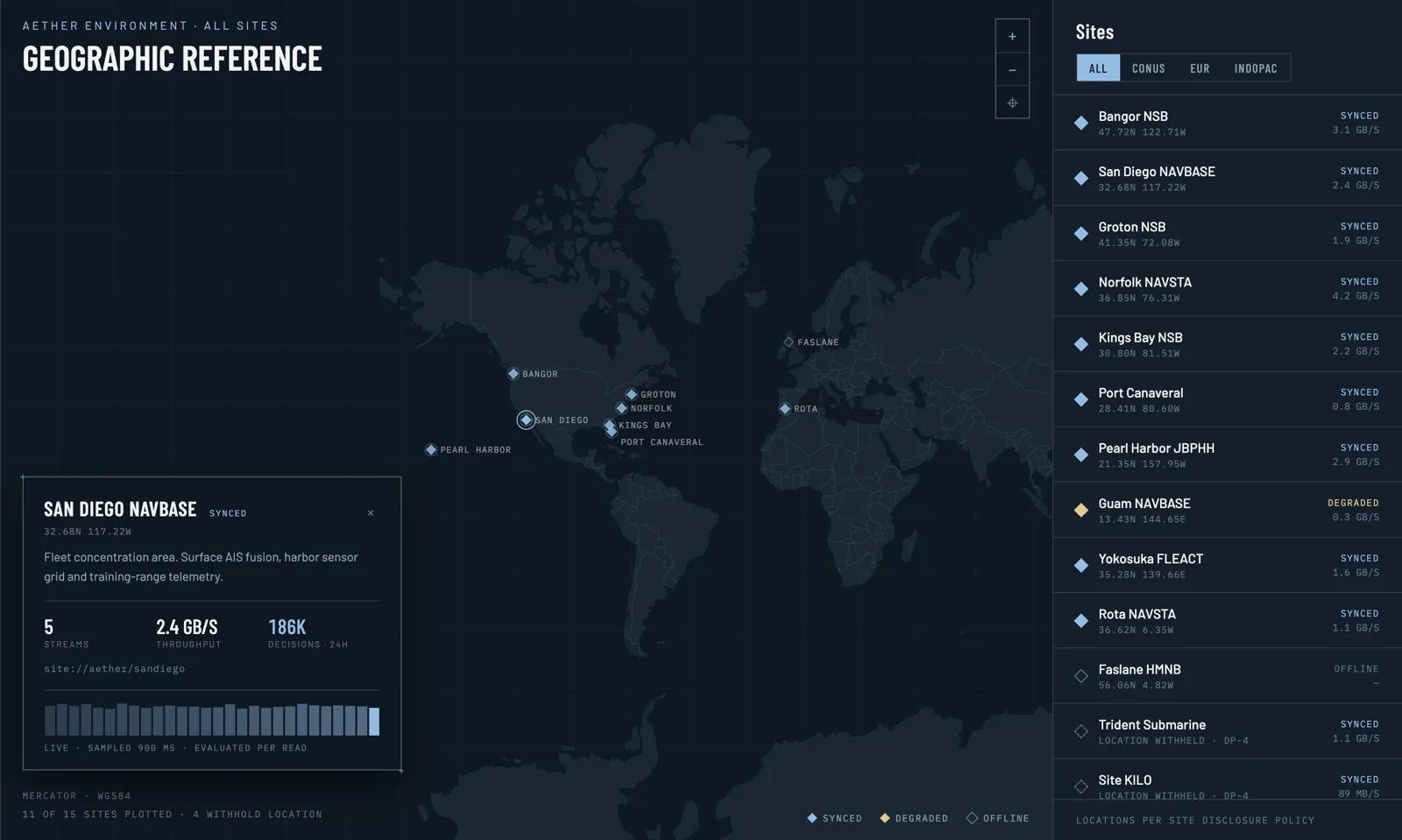
Map
Every site at a glance: blue is synced, amber degraded, and offline sites are drawn hollow because there’s no signal to fill in. Open one for its streams and the last day’s decisions.

Site KILO
A site the system knows about but never puts on the map. Its data still reaches the people cleared to see it.
The whole system
This is a working rebuild. Try it the way a data scientist would: import five files, then hover over the site that won't show its location.

Most of the work was subtraction: cutting steps nobody needed until the product matched the way analysts already worked. Koverse is still an SAIC product today.